🚚 Free Worldwide Shipping on All Orders!Shop Now

1 / 6
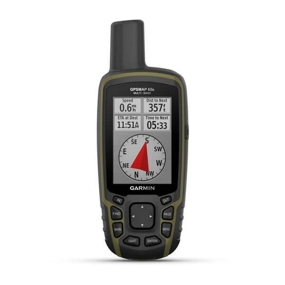
GARMIN GPSMap 65S Multi-Band/multi-GNSS Handheld with Sensors
FIND YOUR WAY IN THIS BIG, WIDE WORLD
Explore more with this rugged handheld that offers optimal tracking accuracy, a 2.6-inch colour display and preloaded maps.
Follow your path.
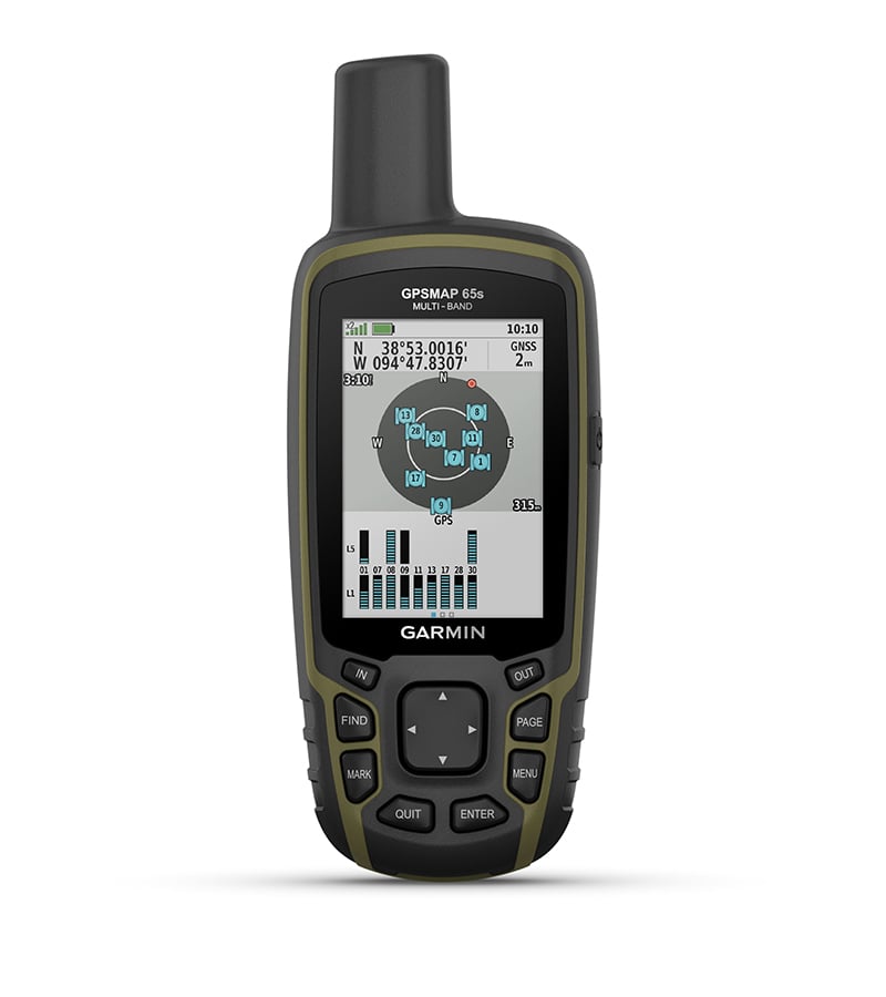 EXPANDED GNSS SUPPORT - Multi-band technology and expanded GNSS support (GPS, GLONASS, Galileo, QZSS and IRNSS) provide optimal accuracy in steep country, urban canyons and forests with dense trees.
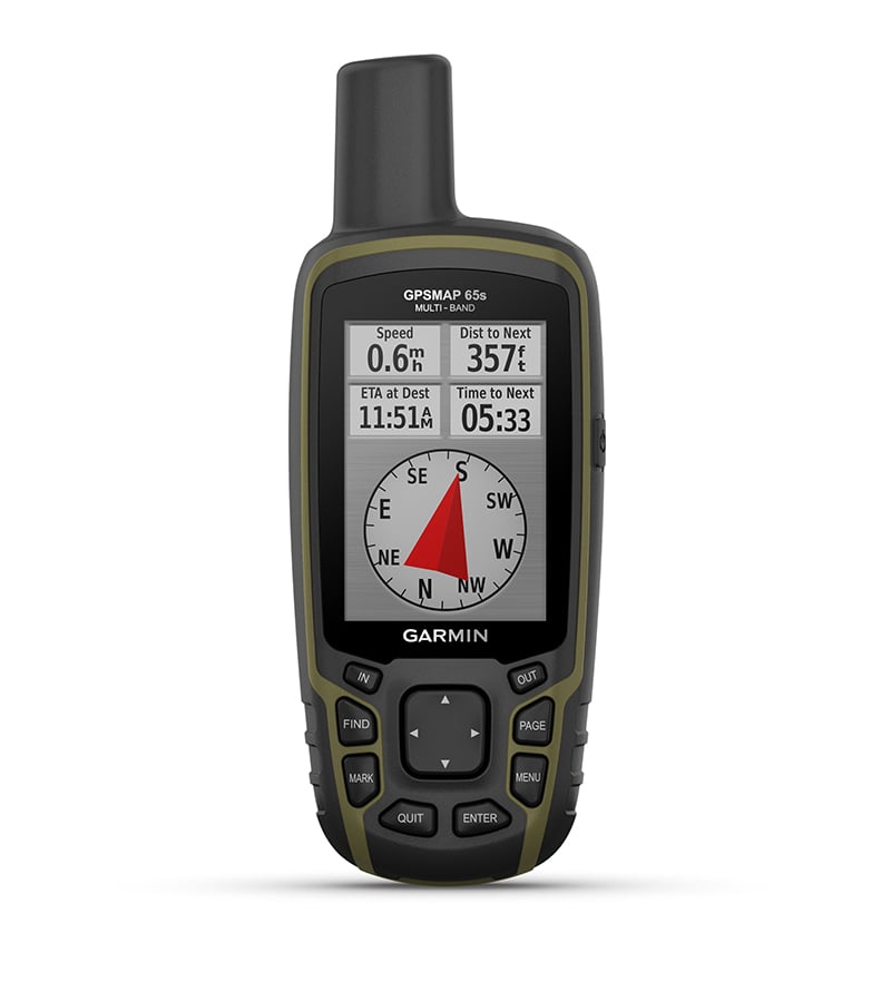 ABC SENSORS - Navigate every trail with ABC sensors, including an altimeter for elevation data, barometer to monitor weather and 3-axis electronic compass.
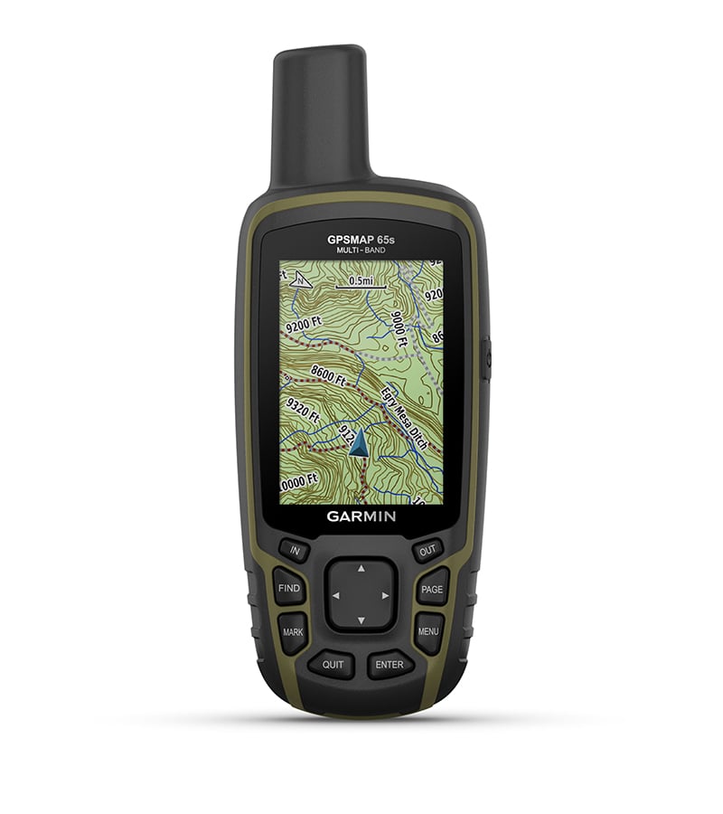 PRELOADED TOPOACTIVE AFRICA MAPS - Preloaded TopoActive Africa maps provide detailed views of street and off-road networks, waterways, natural features, land use areas, buildings and more.
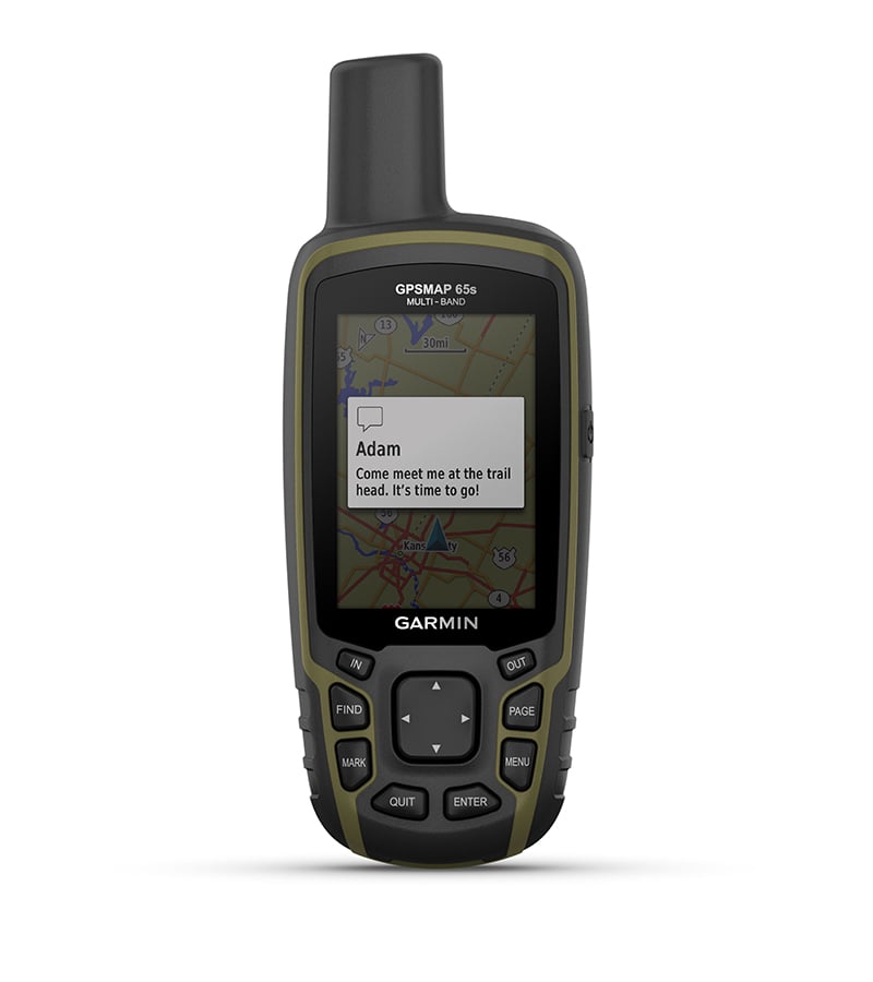 SMART NOTIFICATIONS - Receive emails, texts and alerts right on your handheld when paired with your compatible device.
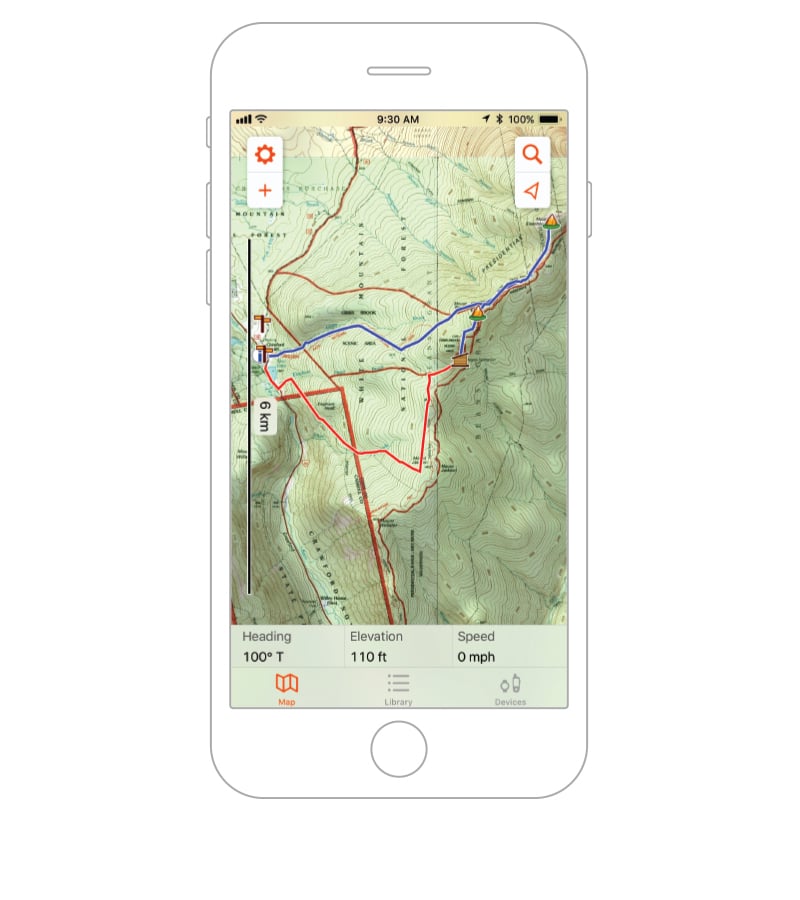 GARMIN EXPLORE APP - Plan, review and sync waypoints, routes and tracks by using the Garmin Explore app1 and website. You can even review completed activities while still in the field.
GEOCACHING - Get automatic cache updates from Geocaching Live, including descriptions, logs and hints.
MICROSD™ SLOT - Using your compatible device and microSD memory card, conveniently download TOPO 24K maps and hit the trail, or access HuntView Plus maps to see public land types and boundaries as well as private landowner names and boundaries.
SPECIFICATIONS
| PHYSICAL DIMENSIONS | 6.1 x 16.0 x 3.6 cm |
|---|---|
| DISPLAY SIZE | 3.6 x 5.5 cm; 2.6-inch diagonal (6.6 cm) |
| DISPLAY RESOLUTION | 160 x 240 pixels |
| DISPLAY TYPE | Transflective, 65K colour TFT |
| WEIGHT | 217 g with batteries |
| BATTERY TYPE | 2 AA batteries (not included); NiMH or Lithium recommended |
| BATTERY LIFE | 16 hours |
| WATER RATING |
IPX7 |
| HIGH-SENSITIVITY RECEIVER | |
| INTERFACE | High-speed mini USB and NMEA 0183 compatible |
| MEMORY/HISTORY | 16 GB (user space varies based on included mapping) |
IN THE BOX
- GPSMAP 65s
- USB cable
- Carabiner clip
- Documentation
*WARRANTY
1 Year Manufacturer's Warranty against defects of manufacture.
$454.46
GARMIN GPSMap 65S Multi-Band/multi-GNSS Handheld with Sensors—
$454.46
Product Information
Product Information
Shipping & Returns
Shipping & Returns
Description
FIND YOUR WAY IN THIS BIG, WIDE WORLD
Explore more with this rugged handheld that offers optimal tracking accuracy, a 2.6-inch colour display and preloaded maps.
Follow your path.
EXPANDED GNSS SUPPORT - Multi-band technology and expanded GNSS support (GPS, GLONASS, Galileo, QZSS and IRNSS) provide optimal accuracy in steep country, urban canyons and forests with dense trees.ABC SENSORS - Navigate every trail with ABC sensors, including an altimeter for elevation data, barometer to monitor weather and 3-axis electronic compass. PRELOADED TOPOACTIVE AFRICA MAPS - Preloaded TopoActive Africa maps provide detailed views of street and off-road networks, waterways, natural features, land use areas, buildings and more.SMART NOTIFICATIONS - Receive emails, texts and alerts right on your handheld when paired with your compatible device.GARMIN EXPLORE APP - Plan, review and sync waypoints, routes and tracks by using the Garmin Explore app1 and website. You can even review completed activities while still in the field.
GEOCACHING - Get automatic cache updates from Geocaching Live, including descriptions, logs and hints.
MICROSD™ SLOT - Using your compatible device and microSD memory card, conveniently download TOPO 24K maps and hit the trail, or access HuntView Plus maps to see public land types and boundaries as well as private landowner names and boundaries.
SPECIFICATIONS
| PHYSICAL DIMENSIONS | 6.1 x 16.0 x 3.6 cm |
|---|---|
| DISPLAY SIZE | 3.6 x 5.5 cm; 2.6-inch diagonal (6.6 cm) |
| DISPLAY RESOLUTION | 160 x 240 pixels |
| DISPLAY TYPE | Transflective, 65K colour TFT |
| WEIGHT | 217 g with batteries |
| BATTERY TYPE | 2 AA batteries (not included); NiMH or Lithium recommended |
| BATTERY LIFE | 16 hours |
| WATER RATING |
IPX7 |
| HIGH-SENSITIVITY RECEIVER | |
| INTERFACE | High-speed mini USB and NMEA 0183 compatible |
| MEMORY/HISTORY | 16 GB (user space varies based on included mapping) |
IN THE BOX
- GPSMAP 65s
- USB cable
- Carabiner clip
- Documentation
*WARRANTY
1 Year Manufacturer's Warranty against defects of manufacture.